Disaster Mapping
26th May 2015

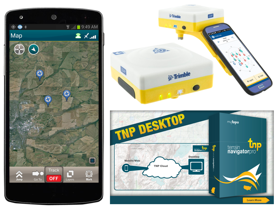 LEAP GNSS receiver is an excellent tool for disaster mapping #WimberleyFlood #TexasFlood #txweather #houstonflood with its ability to photo and video tag survey data points overlayed terrain map imagery that can then be synced with other users via TNP cloud mapping software. Recorded data can also be output for use in GIS mapping software to generate detailed area maps.
Posted by Capital Surveying Supplies on Wednesday, May 27, 2015